MorphoPOS: Morphology
of Public Open Space Accessibility
A two-year postdoctoral research project funded by Marie Skłodowska-Curie Actions Postdoctoral Fellowship (EU Horizon Europe), based at Bilkent University. I will investigate how urban form conditions shape access to public open spaces in rapidly developing cities, using Ankara to explore the gap between objectively measured accessibility and residents' perceptions.
Horizon Europe Fact Sheet via CORDIS: https://cordis.europa.eu/project/id/101244243

There is something counterintuitive about how cities distribute access to public open space. A neighbourhood might sit directly beside a park and still be effectively cut off from it. Another district, with seemingly less public infrastructure on the map, might offer better daily access because the streets connect well, the blocks are permeable, and the spatial sequence from front door to parks, plazas and other public open spaces simply works. This disconnect, or alignment, between what the map shows and what residents actually perceive is the gap I am trying to measure.
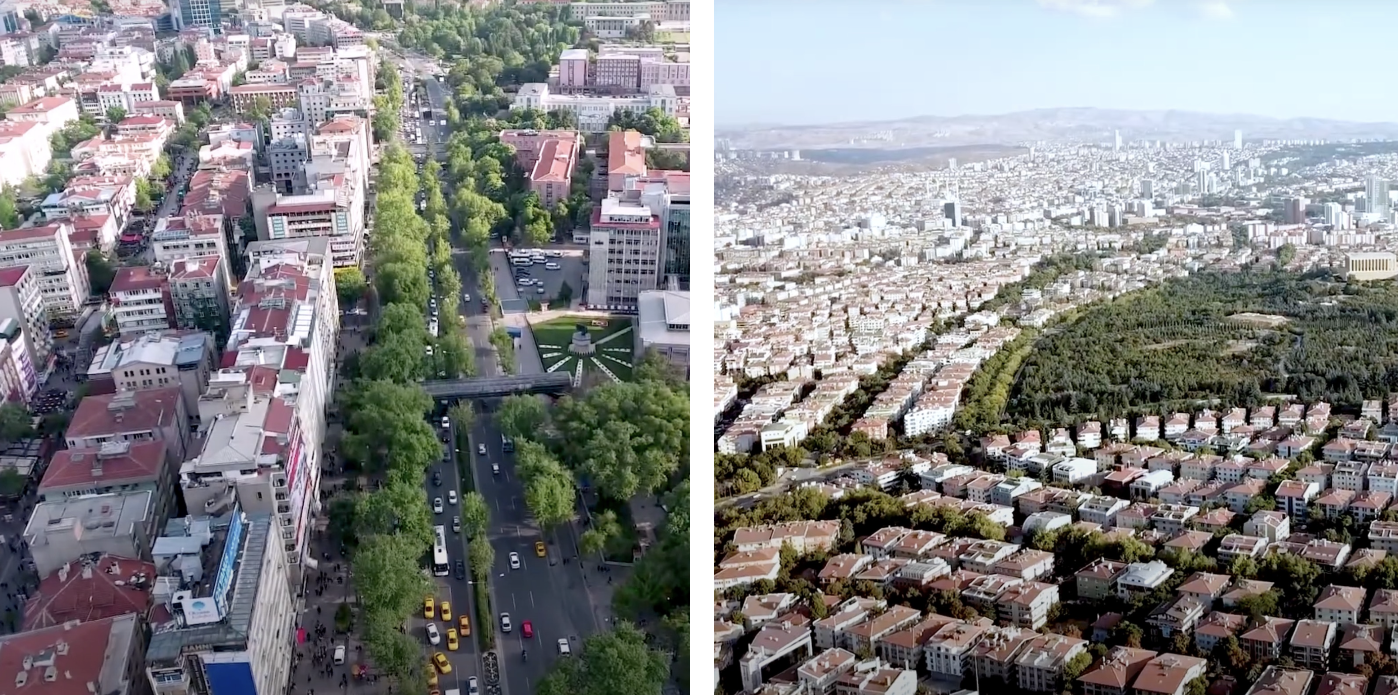
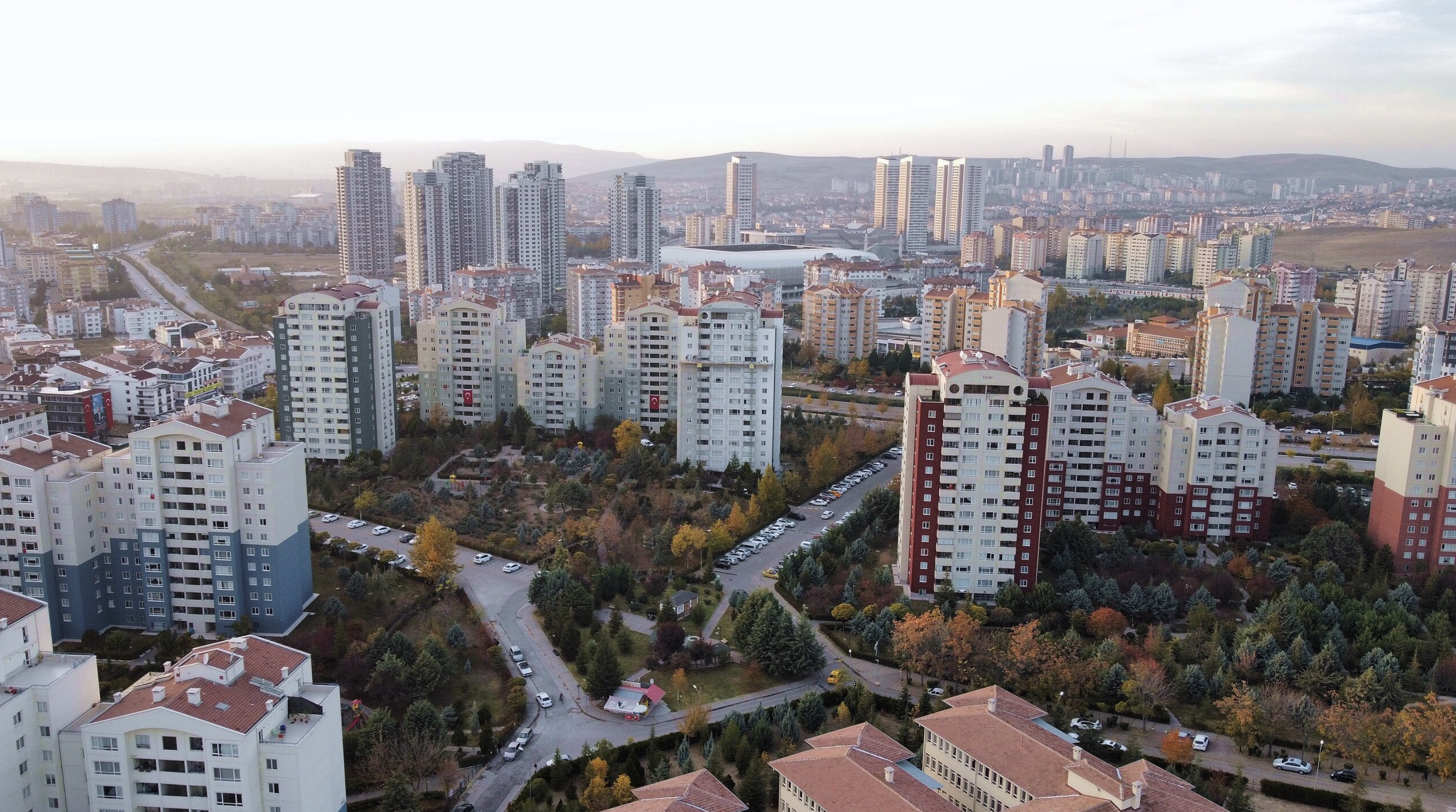
Ankara, the capital of Turkey, makes this visible in an unusually clear way. The city's rapid growth over the past two decades has produced a fragmented patchwork of urban fabrics: dense inner districts, sprawling peri-urban developments, high-rise towers dropped into dispersed suburban fields, and everything in between. Within this heterogeneity, public open spaces have been created, privatised, displaced and absorbed. The result is a city where standard accessibility metrics, per capita area, walking distance thresholds, consistently fail to explain why some residents have rich access to public life and others simply do not.
MorphoPOS investigates whether urban form can answer this question. The hypothesis is that it is not how much open space exists but how streets are configured, how buildings are arranged, and how the city fabric is woven around public open space that determines who can realistically reach it. And beyond the spatial analysis, whether residents' own perceptions of accessibility align with what the data measures, or diverge in ways that reveal something deeper about urban equity.
Funded by a European Commission Marie Skłodowska-Curie Postdoctoral Fellowship (MSCA-PF-2024, €149,365), this 24-month research project runs from July 2026 to June 2028 at Bilkent University's Department of Landscape Architecture & Urban Design in Ankara.
Beyond Proximity: The Morphological Question
Planning practice has long measured public open space accessibility through per capita area or walking distance thresholds. The WHO's 9m² guideline, the 15-minute city model. Both approaches are an improvement on what came before. Neither is enough. Consider two residents living equally close to a park: one steps out of a well-connected street and arrives in minutes; the other faces an oversized block, a fast arterial road, and a detour that makes the same distance feel entirely different. The obstacle is not proximity. It is the urban form and streetscape conditions between the door and the destination.
Urban form can make the far feel near, and the near feel unreachable. A compact, permeable fabric amplifies the accessibility potential of existing public open spaces; a fragmented, impermeable one diminishes it, leaving spaces underutilised even where they exist in abundance. And then there is perception: how residents actually experience these conditions shapes whether they use public open spaces at all, often diverging significantly from what spatial analysis alone would predict. Measuring this gap, and understanding what drives it, is the core of this project.
The Method: Morphometrics, Machine Learning and Perception in Dialogue
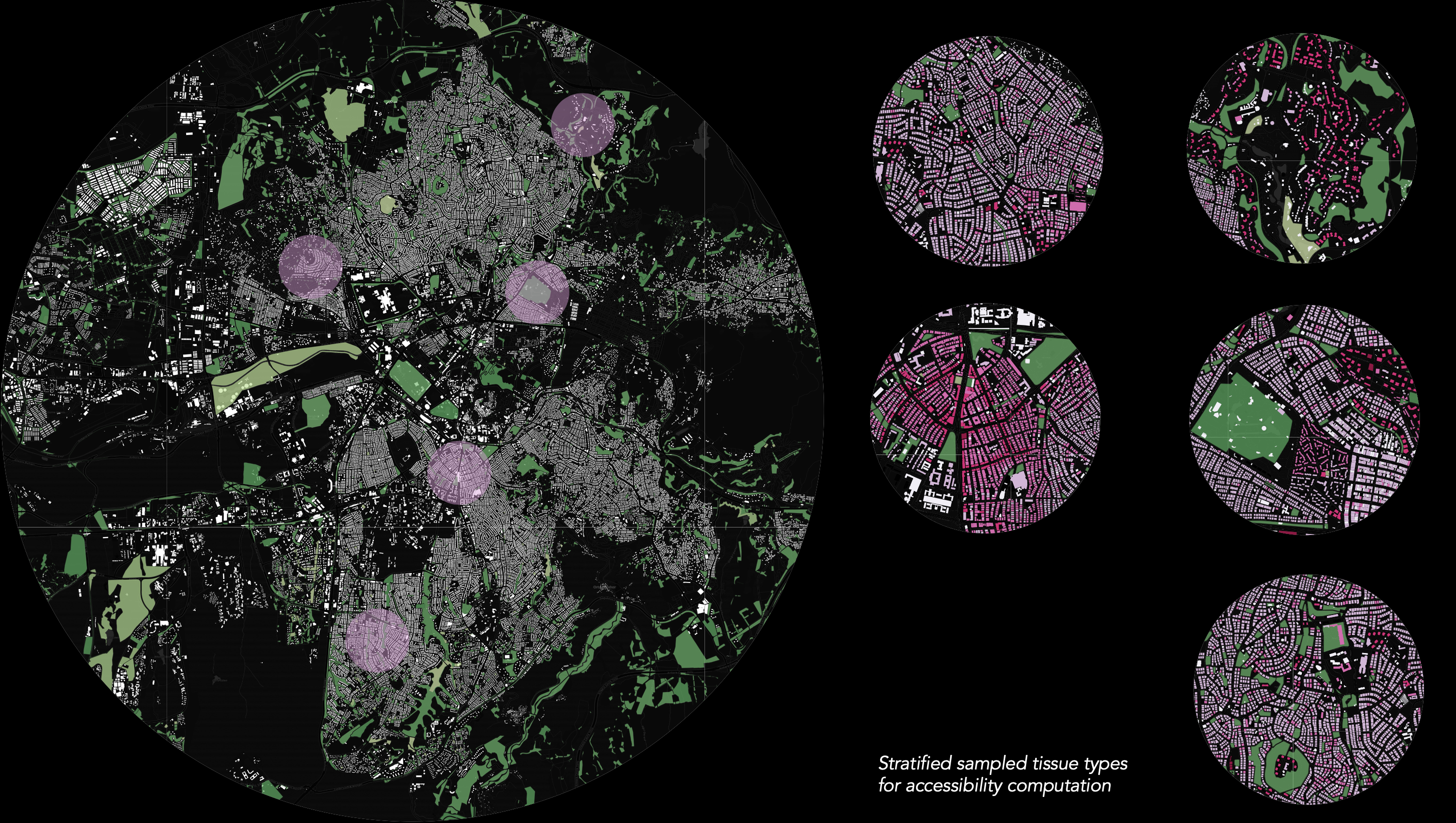
The analytical backbone of the project is urban morphometrics: quantifying how buildings, streets and spatial patterns vary across Ankara's different neighbourhoods, then using spatial data analysis and clustering methods to build a taxonomy of urban form types and their corresponding public open space accessibility conditions. This produces a systematic picture of which morphological configurations facilitate access and which obstruct it.
The perceptive dimension is approached through two complementary methods. Computer vision applied to street-level imagery analyses streetscape qualities, walkability cues and perceived safety conditions across the city at scale. This is paired with in-depth resident interviews, where people walk from their homes to nearby public open spaces and narrate what they encounter. Together, these two arcs connect what the data measures with what people actually feel, and identifying where they align or diverge is where the research's most actionable findings are expected to emerge.
Toward POS-Oriented Retrofitting Strategies
The research is ultimately aimed at producing something practically useful: a diagnostic framework that identifies where public open space accessibility works and where it breaks down, and why. Not every underserved neighbourhood needs a new park. Sometimes the existing infrastructure is adequate but the surrounding urban form prevents people from reaching it. Sometimes a modest intervention in street connectivity or streetscape quality would do more than any new green investment. The framework is designed to tell these cases apart.
This means working in close collaboration with local policymakers and planners in Ankara, translating findings into actionable strategies for prioritising new public open space investments and, equally importantly, for amplifying the influence of what already exists. The method is designed to be replicable, requiring minimal data inputs, so that other rapidly developing cities facing similar pressures can apply the same diagnostic logic to their own contexts.
Anticipated Outputs
Beyond the usual academic outputs, a morphology-based policy framework is aimed at guiding local authorities in Ankara on where and how to intervene, grounded in spatial evidence rather than generic standards. All data, classification methods and equity maps will be made publicly available as a contribution to open science.